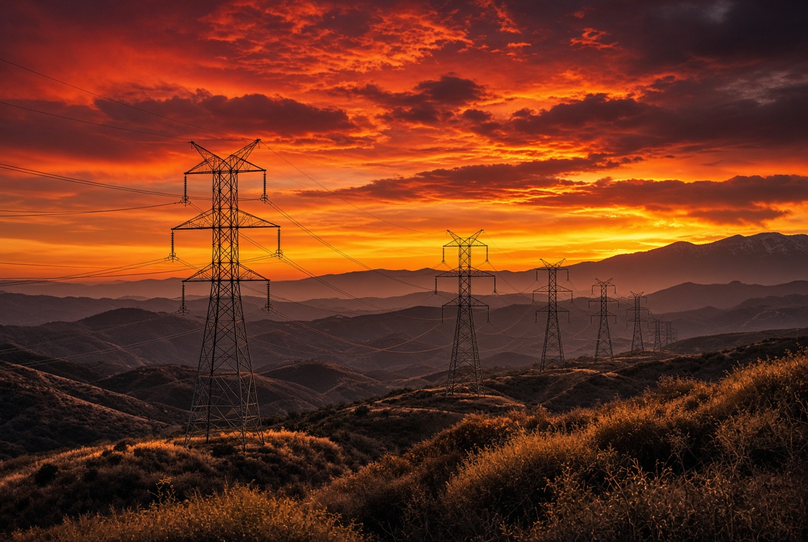
Thousands of homes and businesses north of Los Angeles face the risk of preemptive power cuts over the next one to two days as weak-to-moderate Santa Ana winds bring elevated fire weather conditions to parts of Los Angeles and Ventura counties.Bloomberg
Southern California Edison (SCE) has listed Public Safety Power Shutoffs (PSPS) under consideration for approximately 4,639 customers in Los Angeles County and 297 in Ventura County—roughly 4,900 total—according to figures the utility posted on its website and reported by Bloomberg and local outlets on November 6, 2026. No shutoffs were in effect at the time of those reports. Customer counts are circuit-based and can fluctuate or include overcounts when circuits cross county lines; real-time status is available on SCE’s outage map.Bloomberg
Weather and Fire Conditions
The National Weather Service Los Angeles/Oxnard office issued a Red Flag Warning effective from 2 a.m. to 6 p.m. PST Saturday for the Santa Clarita Valley, western and eastern Santa Monica Mountains, Santa Susana Mountains, western San Gabriel Mountains, and the Highway 14 corridor. Forecasters expect northeast winds of 20–30 mph with gusts to 45 mph (isolated 45–55 mph in favored spots) and relative humidity dropping to 8–20 percent. Fuels remain critically dry despite limited recent rainfall and minor green-up, with live fuel moisture still in the 65–80 percent range in places.Ktla
NWS statements warn that if ignition occurs, “conditions are favorable for extreme fire behavior which would threaten life and property.” Peak winds are expected early Saturday, with elevated fire weather possible from Friday night into Sunday in the broader region. This is a targeted, moderate event rather than the higher-end wind episodes seen earlier in the season.Ktla
Areas of Concern
The greatest risk of shutoffs centers on wind-prone mountain and foothill zones north and west of the Los Angeles basin. Communities and corridors commonly linked to these Red Flag zones and past SCE PSPS activity include the Santa Clarita Valley (Santa Clarita, Valencia, Newhall, Castaic areas), portions of the Santa Monica Mountains, and adjacent unincorporated areas. Exact impact is circuit-specific: neighboring homes on different circuits can experience different outcomes. Residents in or near high fire-threat districts (Tier 2/3) served by overhead lines are most likely to be affected.Ktla
SCE’s decision process relies on real-time data from pole-top weather stations, vegetation dryness, and humidity rather than a single county-wide forecast. The utility de-energizes lines when the risk that equipment could spark a fire becomes unacceptable under those conditions.
Utility Response and Broader Context
SCE has described PSPS as a last-resort safety measure to reduce the chance of wind-blown debris contacting lines or equipment during extreme fire weather. After conditions improve, crews patrol and inspect lines before restoration, a process the utility says can take up to eight hours (longer if damage is found or daylight is required for safe work). Customers can sign up for alerts via My Account or address-level notifications on the SCE site.Sce
This episode occurs during California’s most dangerous stretch of its year-round fire season, when hot, dry offshore winds commonly coincide with dry fuels. Seasonal Santa Ana events have driven some of the state’s most destructive fires, including the January 2025 blazes around Los Angeles that destroyed more than 16,000 structures. Mid-October 2026 saw much larger potential and actual PSPS scopes (tens of thousands of customers in LA and Ventura counties under consideration or affected amid stronger winds). Recent rains have offered limited mitigation, but vegetation in many wind corridors remains dry enough for rapid fire growth.Claimsjournal
No major official SCE social-media announcements specifically detailing this November 6 event were prominent in recent posts; the utility’s primary communication channel for status remains its outage map and PSPS pages. Other California investor-owned utilities (PG&E, SDG&E) were not highlighted in reports of this particular southern California event.
What Residents Should Do
- Check the SCE outage map and sign up for notifications.
- Prepare for possible multi-hour outages: charge devices, stage flashlights, plan for medical equipment, and review go-bags.
- Avoid activities that could spark fires.
- Monitor NWS Los Angeles/Oxnard forecasts and local emergency alerts.
Conditions and the list of circuits under consideration can change quickly with observed winds and humidity. Customers should treat the official utility map and notifications as the authoritative source.
Appendix: Sources and Links
- Bloomberg: “California Homes Face Shutoffs as Santa Anas Raise Fire Risks” (Nov. 6, 2026) — https://www.bloomberg.com/news/articles/2026-11-06/california-homes-face-shutoffs-as-santa-anas-raise-fire-risks
- Claims Journal / Insurance Journal reprint of Bloomberg reporting — https://www.claimsjournal.com/news/national/2026/11/06/341164.htm and https://www.insurancejournal.com/news/west/2026/11/06/891853.htm
- KTLA: “Thousands face possible power shutoffs amid heightened SoCal fire danger” (Nov. 6, 2026) — https://ktla.com/news/california/southern-california-santa-ana-winds-wildfire-risk/
- Southern California Edison Outage Center / PSPS status pages — https://www.sce.com/outages-safety/outage-center/check-outage-status and https://www.sce.com/outages-safety/outage-preparedness/outage-types/public-safety-power-shutoff-psps
- SCE Outage Map — https://www.sce.com/outagemap
- National Weather Service Los Angeles/Oxnard Red Flag Warning and fire weather products (Nov. 6, 2026) — weather.gov/lox and related text products
- NBC Los Angeles / local weather coverage of Red Flag Warning and Santa Ana forecasts
- MyNewsLA and related local reports on Santa Ana winds and Red Flag areas
- Prior SCE PSPS context from October 2026 events (Reuters, local city posts, and utility reports) for seasonal background
All customer numbers and status details are time-sensitive; verify the latest information directly with SCE.